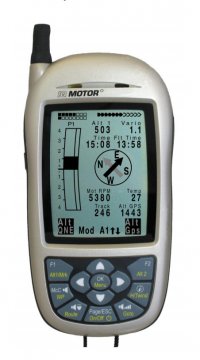
| Standard Functions |
| Altimeters |
 |
| Pressure adjustment - QNH manual |
 |
| Vario with 5 readings/s |
 |
| easy instrument settings by menu |
 |
| Digital vario filter adjustable |
 |
| ASI ( Acoustic Scale Indication ) |
 |
| acoustic by user adjustable |
 |
| Vario averager |
 |
| variorange up to +/- 300 m/s |
 |
| Audio for vario |
 |
| Battery level monitoring, temperature compensated |
 |
| Flight timer |
 |
| Intelligent Launch detection |
 |
| Intelligent Landing detection |
 |
| numbers of flights recorded (peak data) |
100 |
| Flight memory hours at 60 or 20 sec. scan rate |
291/97 |
| max. Trackpoints |
24000 |
| metric or imperial units |
 |
| scratch resistant plastic film (option ) |
 |
| Display protection by 1,5 mm perplex scale |
 |
| aerodynamic housing |
 |
| robust ABS housing |
 |
| number of intuitive softkeys at the keypad |
2 |
| SD-slot for later software upgrades |
 |
| wireless transfer of engine data by FLYLINK |
 |
| RPM |
 |
| CHT or EGT depending of sender |
 |
| Advanced Functions |
| Automatic flight accepting |
 |
| Simulation mode |
 |
| Vario Tone Acoustic highly adjustable |
 |
| number of userfields available |
32 |
| No of pages of userfields |
3 |
| user customizable display |
 |
| graphical history of vario and height |
Vario |
| map display with zooming and panning |
 |
| high resolution graphics |
 |
| adjustable polars |
 |
| USB1.1 data in/out to PC |
 |
| FLARM |
 |
| number of independant battery banks and total operation hours |
2/40 |
| Auto power off after 30 min if no use |
 |
| rotating speed sensor connection |
 |
| speed sensor calibration ( pitot or vane sensor ) |
 |
| Stall alarm dependant on altitude (with vane-or pitotsensor) |
 |
| GPS-Funktions |
| 20 channel GPS receiver |
 |
| 3D flight logger IGC format |
 |
| No of waypoints |
200 |
| No of routes |
20 |
| No of waypoints/route |
30 |
| compass rose for intuitive navigation |
 |
| wind direction with windspeed |
 |
| Restricted Areas Functions |
| optinal restricted area-memory up to |
150 |
| display of restricted areas in map |
 |
| upload of restricted areas with PC from standard programs |
 |
| user defined restricted ares (special areas) |
 |
| calculation of individual distance to a restricted area |
 |
| Datatransfer to PC ( Microsoft WIN ) by Bluetooth ( SD card upgrade necessary ) |
| up- and download of flights/firmware |
 |
